Week 307 Tujunga Ponds Wildlife Sanctuary, Sunland
June 23, 2024AllTrails Tujunga Ponds Loop, 2.49 miles (original 2.1).
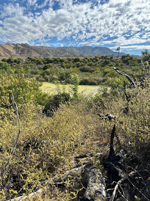
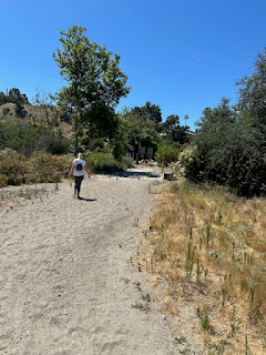
Adventure, curiosity, and some trail lessons filled Barbara's and my first visit to this stunning riparian woodlands in Sunland. In 1978, LA County Parks & Rec acquired the 13 acres that make up the Wildlife Sanctuary in an effort to replace the wildlife habitat displaced when construction on the Foothill Freeway (210) tore through the natural wildlife corridor moving south from the San Gabriels. West of the sanctuary in 1998, the LA Flood Control District acquired another 210 acres as mitigation for the damage and to replace wetlands destroyed by the 210 construction. The result? The most stunning acreage of dense willow and cottonwood riparian woodlands in the county. A short, 2.1 mile hike, we left earlier than usual to dodge the heat. Arrived at the trailhead at 8:20, and all was well until 10 when temps rocketed. The first half of the hike was a challenging mix of dirt trails, mud trails, rock bed trails. While there were very few wildflowers, the woodlands and chaparral stood gorgeous. We hiked under quaking aspens, stood under seeding chaparral yucca, then hit a spot on the trail lush with unfamiliar tall greenery with wiry stems. We usually do a name search but this time we didn't and found out fast when, as we parted stems blocking the trail, the stinging nettles attacked and OUCH. My fingers still sting! About a third of the way in the trail followed a chain fence separating the habitat from the sanctuary. Around a curve the two Tujunga Ponds came into view. Ducks, baby ducks, and a couple of different water birds rested in ponds surrounded by bulrush. We stopped for a quick water and snack break. then moved ahead, finding out that the trail around the second pond was a stream! We edged between the pond and bulrush and the stream in the mud along the bank. Four women on horseback (surprised to see us slogging through the mud LOL) came up the stream, assuring us that the water was, at best, ankle deep. Well yeah we kept going! We passed the ponds and turned south for the return trail at around 10, and the heat hit hard. Part of our return trail was another stream, but deeper, and the plants lining the bank that we needed for support were....nettles! Had to backtrack, adding another .4 miles to the hike. Found an off-route trail with a makeshift bridge over the stream that reconnected us to our route and the trailhead. The hike is gorgeous, unusual, and adventurous. Not recommended after a rain, and you definitely need a reliable trail tracker like AllTrails to follow. The trails are not marked and a few of the spots weren't trails at all. A horse would work! Memorable hike.


0 comments