Week 174: Monterey Park
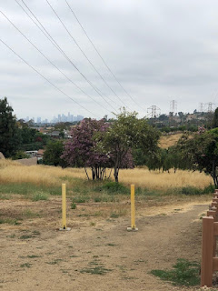
May 12, 2019Barbara and I had no idea what to expect when we decided to follow Charles Fleming's Monterey Park hike from the November 11, 2018, L.A. Times. Monterey Park, population 60K, is about 7-miles east of L.A. in the San Gabriel Valley. Small, clean, culturally diverse, in 2017, Money Magazine placed Monterey Park in the top three of "America's best places to live and raise a family." Part of Mission San Gabriel lands in the 18th-century, the first non-Indian/non-Spanish ranch house was built post-Civil War on a site close to the present SoCal Edison station (our turnaround point today.) Monterey Park became an official city in 1916, taking its name from "Monterey Hills" on a govt. map. In the 1920s, the first Asian residents and farmers arrived. The population grew between 1940-1950 as Asians, WWII vets, and Latinos took advantage of the small-town urban culture of new subdivisions in a quiet, convenient location. By the 1990 census, Monterey Park had become the first city with an Asian-descent majority population in the continental US, earning the monikers "Chinese Beverly Hills" and "first suburban Chinatown." Barbara and I exited the 60, driving through peaceful and unassuming neighborhoods to La Loma Park, our starting point. We crossed the street to Edison Trails Park, an 11-acre stretch of land with a central dirt trail running for about a mile under a string of high-tension electrical towers and transformers. Okay, the trail wasn't much to look at, and the overcast sky allowed only modest views (though we did catch a glimpse of DTLA.) The path rose, it fell, we kicked up dirt, and aside from a few dog-walkers, had the path to ourselves all the way to our turnaround point, the SoCal Edison station on Garfield Avenue. After a water break and photos with the playground lion, we retraced our route. Though this hike didn't have bells, whistles, or wows, (or even dumplings) it was challenging enough to boost our heart-rates for a good workout. A solid local trail.


0 comments